
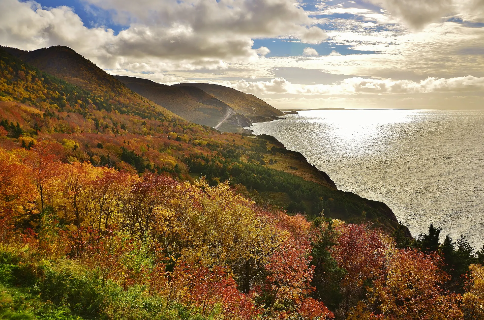
Cabot Trail Road Trip Itinerary: 3 Days from Halifax (Plus a 5-Day Version)
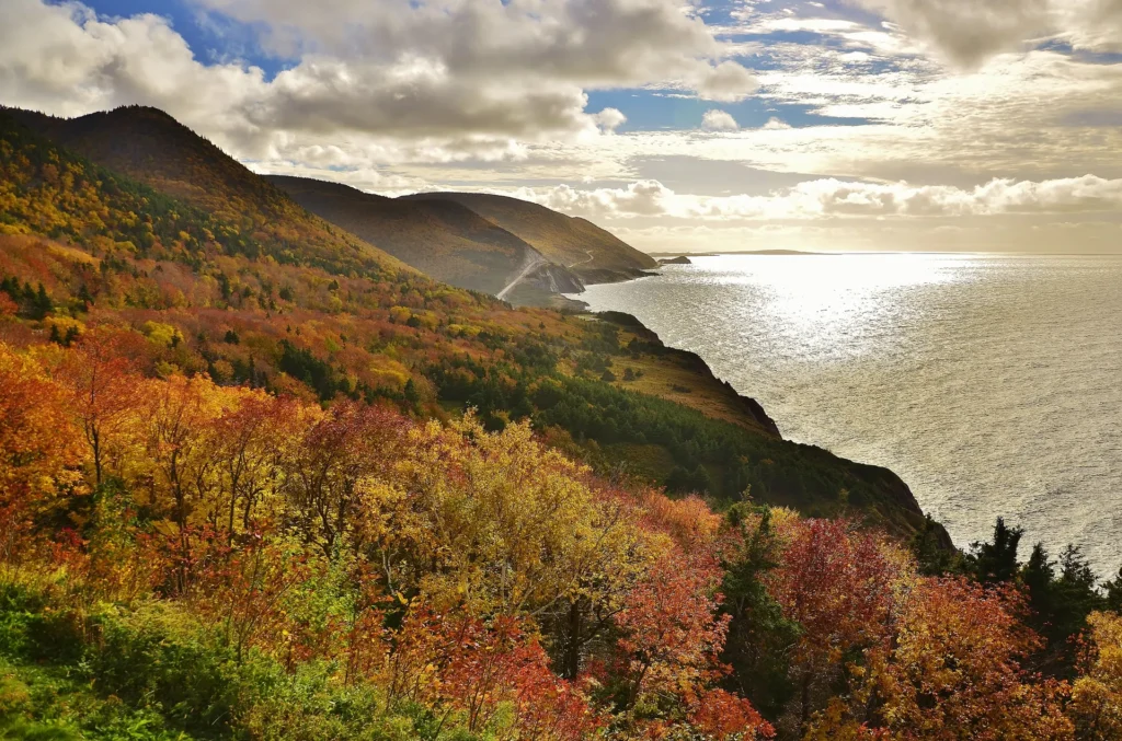
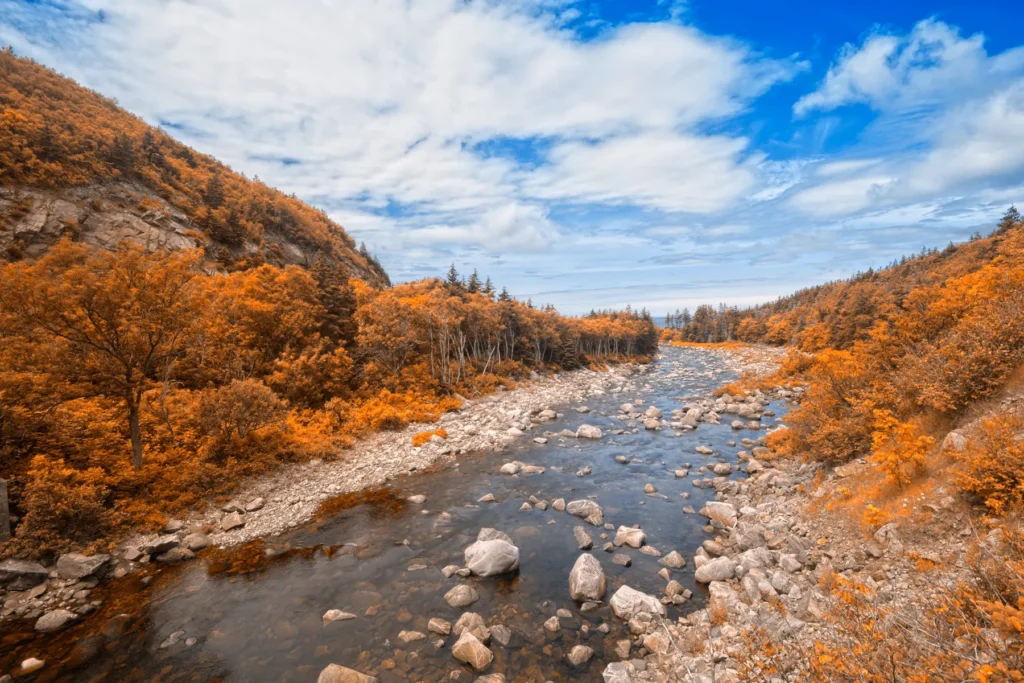
There are scenic drives, and then there’s the Cabot Trail. This 298-kilometre loop around the northern tip of Cape Breton Island climbs into the highlands, drops down to the sea, and threads through Acadian, Gaelic and Mi’kmaw communities along the way. Whales surface off the coast, moose wander the roadsides, and in autumn the hills turn every shade of red and gold.
For anyone in Halifax, it’s the ultimate road trip without boarding a plane. This itinerary gives you a realistic three-day plan, an optional five-day version, the best stops and hikes, and the practical details that make the trip smoother.
Heads up: some links in this guide are affiliate links. If you book through them, Moonlight Travel may earn a small commission at no extra cost to you. Read our affiliate disclosure.
In this guide
The Cabot Trail at a glance
| Trip facts | Details |
|---|---|
| Length | About 298 km (185 miles) as a loop |
| Driving time | Tourism Nova Scotia suggests 3 to 6 hours without stops; plan 2 to 3 days to enjoy it |
| From Halifax | Around 4 hours to Baddeck; Parks Canada estimates about 5 hours to the national park |
| National park | About 106 km of the trail runs through Cape Breton Highlands National Park |
| Park pass | Required to stop and use the park’s trails and facilities; check current fees with Parks Canada |
| Best season | June to mid-October, with peak fall colour usually in late September to mid-October |
The loop is usually started and finished in Baddeck, a pretty village on the Bras d’Or Lake, which is part of a UNESCO biosphere reserve. From Halifax, you’ll drive up Highway 102 and Highway 104, cross the Canso Causeway onto Cape Breton Island, and follow Highway 105 to Baddeck.
Which direction should you drive?
Both directions are spectacular, and Parks Canada simply notes that the scenery feels different each way. Here’s the practical difference:
- Clockwise (Baddeck → Margaree → Chéticamp → Pleasant Bay → Ingonish): you’ll be in the inside lane on the dramatic west-coast cliffs, which nervous drivers often prefer, and you reach the Skyline Trail early in the trip.
- Counterclockwise (Baddeck → Ingonish → Pleasant Bay → Chéticamp): you’ll be in the ocean-side lane on the west coast, with the views right outside your window.
This itinerary goes clockwise, which puts the Skyline Trail on day two when you’re fresh.
Day 1: Halifax to Baddeck
Leave Halifax mid-morning and you’ll be in Baddeck by mid-afternoon with time to spare. Good stops on the way include the Canso Causeway viewpoint and a coffee break in Port Hastings.
Compare rental cars from Halifax on DiscoverCars →
In Baddeck:
- Alexander Graham Bell National Historic Site. Bell spent his summers here, and the museum covers his work on everything from the telephone to hydrofoils and early aircraft.
- A walk along the waterfront as the light fades over the Bras d’Or Lake.
- Book dinner ahead in peak season. Baddeck fills up fast in summer and during the fall festival.
Stay overnight in or near Baddeck so you can start the loop early.
Day 2: Margaree, Chéticamp and the Skyline Trail
This is the big day. Get on the road early.
Margaree Valley
Head west from Baddeck through the Margaree Valley, known for its winding river, its autumn colour and its salmon fishing. It’s a gentle, pastoral start before the drama begins.
Chéticamp
On the west coast you’ll reach Chéticamp, a proud Acadian community with bright houses, a striking church and a long tradition of hooked rugs. Stop at Les Trois Pignons, a cultural centre with a celebrated hooked-rug collection, then pick up your park pass at the Parks Canada visitor centre at the park’s western entrance.
The Skyline Trail
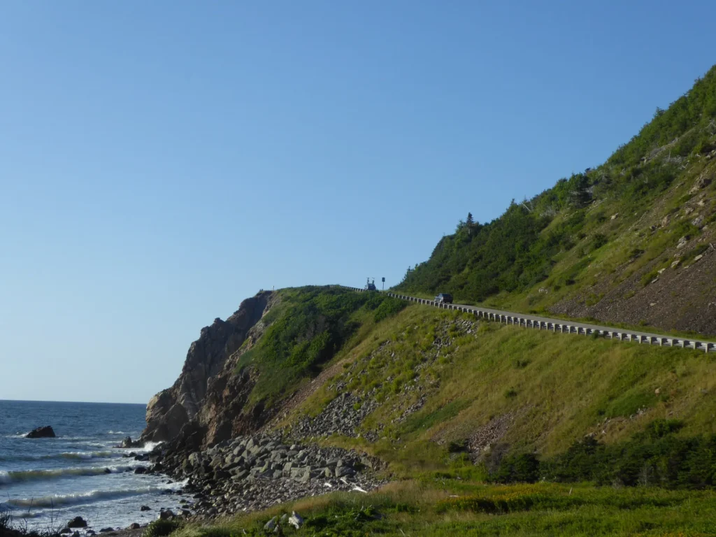
Just past Chéticamp, the road climbs French Mountain to the trailhead for the Skyline Trail, the most famous hike in the park. Parks Canada lists it at about 6.5 km return, or 8.2 km as a loop, and rates it easy, taking roughly 2 to 3 hours. It ends at a boardwalk on a headland high above the Gulf of St. Lawrence, where you can often spot whales below and watch the Cabot Trail snaking down the mountainside.
Pleasant Bay
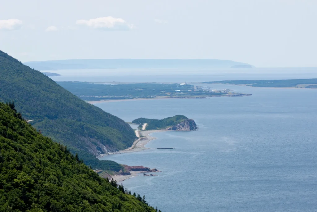
Descend MacKenzie Mountain into Pleasant Bay and end the day here or continue toward Cape North. Pleasant Bay is known for whale-watching tours in season and has a Whale Interpretive Centre that’s perfect for kids.
Day 3: Pleasant Bay to Ingonish and home
The Lone Shieling and the highlands
Stop at the Lone Shieling, a short, easy walk through an old-growth hardwood forest to a replica Scottish crofter’s hut, a nod to the island’s Highland Scottish heritage.
Cape North and Neils Harbour
Near Cape North you can detour north toward Bay St. Lawrence and Meat Cove, the northernmost community in Nova Scotia. The final stretch to Meat Cove is a narrow gravel road, so take it slowly. Back on the main loop, Neils Harbour has a lighthouse that has served ice cream in summer, one of the trail’s sweetest little rituals.
Ingonish
On the east side of the park, Ingonish offers beaches, the classic Middle Head Trail out onto a narrow peninsula, and, for strong hikers, the steep Franey Trail with sweeping views over the coast. Golfers will know the famous Highlands Links course here.
From Ingonish, the trail climbs over Cape Smokey and follows St. Ann’s Bay back toward Baddeck. Near St. Ann’s you’ll pass the Gaelic College, a centre for Gaelic language, music and dance. From there, it’s about four hours back to Halifax.
Got more time? The five-day version
If you can spare five days, slow down and add:
- A whale-watching tour from Pleasant Bay or Bay St. Lawrence.
- A full day of hiking in the national park, mixing the Skyline Trail with Middle Head and the Franey Trail.
- Meat Cove as an unhurried side trip, with time to sit on the cliffs.
- The Fortress of Louisbourg near Sydney, a huge reconstruction of an 18th-century French fortified town, operated by Parks Canada.
- A night of Cape Breton music at a local ceilidh or kitchen party.
When to go
- Summer (July to August): warm weather, long days, whale-watching season and all services open. Also the busiest time, so book accommodation early.
- Fall (late September to mid-October): the most famous season for good reason, with blazing hillsides. The Celtic Colours International Festival takes place across the island in October, so rooms go fast.
- June: quieter, green and fresh, with fewer crowds.
- Winter: the park is open year-round but full visitor services are typically only available from mid-May to mid-October, and road conditions can be challenging.
Cabot Trail driving tips
- Fuel up in Baddeck, Chéticamp or Ingonish. Gas stations are sparse in the highlands.
- Download offline maps. Cell coverage is patchy in parts of the park, especially on the west side.
- Watch for moose, especially at dawn and dusk. They’re big, dark and hard to see at night.
- Use a lower gear on steep descents like French Mountain and MacKenzie Mountain to save your brakes.
- Use the pull-offs for photos. Never stop on the road itself.
- Book your car early if you’re flying into Halifax. Rental cars at the airport can sell out in summer and fall.
Trip essentials for your Cabot Trail road trip
What we’d book before setting off. Check current prices and terms before you buy.
- Rental car from HalifaxCompare rental companies at Halifax airport. Search DiscoverCars →
- More car rental dealsA second search to compare. Try Economybookings →
- Hotels & innsBook Baddeck, Chéticamp and Ingonish early. Search Trip.com →
- Flying in to Halifax?Compare flights to YHZ. Search Aviasales →
- Visiting from outside Canada?Get mobile data without roaming fees. See Airalo eSIMs →
- Travel insurance for visitorsMedical cover for your trip to Canada. Compare plans →
Keep exploring
- Dreaming bigger? See the cheapest places to fly from Halifax for your next adventure.
- Heading abroad after this? Our guide to the best eSIM for Canadians travelling abroad will keep you connected for less.
FAQ: Cabot Trail road trip
How long does it take to drive the Cabot Trail?
Tourism Nova Scotia suggests allowing 3 to 6 hours of driving for the 298-km loop without stops. To enjoy the hikes, viewpoints and villages, plan at least two full days, ideally three, plus travel time from Halifax.
Do I need a park pass for the Cabot Trail?
You can drive through on the road, but a Parks Canada pass is required if you stop to use trails, lookouts or other facilities in Cape Breton Highlands National Park. Passes are sold at the visitor centres in Chéticamp and Ingonish and online; check current fees with Parks Canada.
Is it better to drive the Cabot Trail clockwise or counterclockwise?
Both are beautiful. Clockwise keeps you in the inside lane on the west-coast cliffs; counterclockwise puts you in the ocean-side lane there. Choose based on your comfort with heights and which stops you want to reach first.
When is the best time to see fall colours on the Cabot Trail?
Peak colour usually arrives from late September to mid-October, though timing varies year to year. That’s also when the Celtic Colours festival runs, so book accommodation early.
How hard is the Skyline Trail?
Parks Canada rates it as easy. The out-and-back route is about 6.5 km and the loop about 8.2 km, taking around 2 to 3 hours. There are steps on the boardwalk at the headland.
Can you see whales from the Cabot Trail?
Yes, whales are often seen in summer and early fall, sometimes from the Skyline Trail lookout. For the best chance, join a whale-watching tour from Pleasant Bay or Bay St. Lawrence.
Distances and trail details come from Parks Canada and Tourism Nova Scotia, checked in October 2026. Always check road, trail and park conditions before you travel.
Featured photo: Autumn colours on the Cabot Trail highlands above the ocean in Cape Breton. Photo: Eric Van Lochem via Wikimedia Commons, CC BY-SA 4.0 (licence).
Related guides


The Moonlight Letter
Get Halifax & Atlantic Canada travel deals
Cheap-flight finds from YHZ, road-trip ideas and new guides, straight to your inbox.
We'll only use your email to send Moonlight Travel deals and guides. Unsubscribe anytime. See our Privacy Policy.