Gros Morne National Park Hikes: The Best Trails, Easy to Hard
Last checked: November 1, 2026. Trail lengths, times, ratings, closures and fees in this guide come from Parks Canada’s Gros Morne hiking page and fees page; ferry details from Marine Atlantic; airport details from Deer Lake Regional Airport. Conditions change, so check Parks Canada before you go.
Heads up: some links in this guide are affiliate links. If you book through them, Moonlight Travel may earn a small commission at no extra cost to you. It helps keep our guides free. Read our affiliate disclosure.
Gros Morne, on Newfoundland’s west coast, is a UNESCO World Heritage Site and one of the best hiking parks in eastern Canada. Parks Canada counts more than 100 km of trails, from half-hour strolls to strenuous day hikes. This guide covers the 10 best Gros Morne National Park hikes, from easy to hard, with Parks Canada’s official lengths and times, plus when to go and how to get there from Halifax. Most trailheads are a drive apart, so if you’re flying in, compare rental cars at Deer Lake early in your planning.
In this guide
Gros Morne hikes at a glance
Here are our 10 picks. Every length, time and rating comes from Parks Canada. Times are return trips at a normal pace, so add time for photos and breaks.
| Trail | Length | Time | Difficulty | Highlight |
|---|---|---|---|---|
| Tablelands | 4 km return | 1–2 hours | Easy | Walk on exposed mantle rock |
| Western Brook Pond | 6 km return | 1–2 hours | Easy | Fjord views; boat tour dock |
| Southeast Brook Falls | 700 m return | 0.5 hour | Easy | 40 m waterfall |
| Berry Head Pond | 2 km loop | 0.5–1 hour | Easy | Boardwalk, birds and bog |
| Coastal Trail | 6 km return | 1–2 hours | Easy | Cobble beaches and sunsets |
| Berry Hill | 1.5 km return | 0.5–1 hour | Moderate | Short climb, big views |
| Baker’s Brook Falls | 10 km return | 2–3 hours | Moderate | Cascades over limestone |
| Lookout Trail | 5.8 km loop | 2–3 hours | Moderate | Views of Bonne Bay and the Tablelands |
| Green Gardens | 9 km return | 3–4 hours | Moderate | Sea stacks, meadows, sea cave |
| Gros Morne Mountain | 17 km return | 6–8.5 hours | Difficult | Summit of the park (806 m) |
Parks Canada’s rating guide explains the labels. Easy: under 100 m of gain and 2 hours. Moderate: up to 500 m and under 5 hours. Difficult: may exceed 500 m and 5 hours, for experienced, well-equipped hikers.
Best short and easy hikes
Tablelands Trail (4 km return, 1–2 hours, easy)
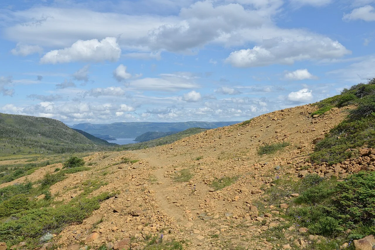
This is the hike that makes Gros Morne famous. The trail follows an old roadbed along the base of the Tablelands, a barren, orange-brown massif of rock that, Parks Canada explains, was pushed up from beneath the ocean when the continents of Africa and North America collided. Few plants can grow on it, which is why it looks so unlike the green hills around it. The trail ends in the glacier-carved Winter House Brook Canyon, and the shorter Serpentine Loop branch shows off the rare plants that do survive here. The trailhead is 4 km west of the Discovery Centre in Woody Point on Route 431, and Parks Canada runs guided interpretive hikes from here in summer. Elevation gain is just 88 m. Please stay on the trail to protect the tiny plants.
Southeast Brook Falls (700 m return, 0.5 hour, easy)
A quick stop near the park entrance at Wiltondale, 9 km north on Route 430. A short walk through fir and birch forest leads to the top of a 40-metre waterfall, at its best during spring run-off.
Berry Head Pond and Berry Hill
Both start near Rocky Harbour. Berry Head Pond (2 km loop, easy) begins with 350 m of wheelchair-accessible boardwalk before a narrow path circles the pond through forest and bog, good for songbirds and waterfowl. Berry Hill (1.5 km return, moderate) is short but steep, with stairs and benches, climbing 92 m to viewpoints over the Long Range Mountains.
Coastal Trail (6 km return, 1–2 hours, easy)
Starting at the Baker’s Brook parking lot, 10 km north of Rocky Harbour, this trail follows the old winter mail road past cobble beaches and dense, wind-stunted “tuckamore” forest. A good sunset walk.
Moderate half-day hikes
- Lookout Trail (5.8 km loop, 2–3 hours, 363 m gain): climbs from the Discovery Centre parking lot in Woody Point to a platform on Partridgeberry Hill, with one of the best panoramas in the park: Bonne Bay, Gros Morne Mountain, the Tablelands and the Lookout Hills.
- Green Gardens (9 km return, 3–4 hours, 415 m gain): crosses serpentine barrens and forest to a coast of cliffs, sea stacks and meadows at Old Man Cove, with stairs down to a beach with waterfalls and a sea cave. The trail passes near cliff edges, so stay well back.
- Baker’s Brook Falls (10 km return, 2–3 hours, 195 m gain): starts in Berry Hill campground and leads through balsam fir forest to a series of cascades over limestone ridges. Look for the fenced “moose exclosure” that shows what the forest looks like without moose browsing. Much of it is sheltered forest, so expect biting insects.
Western Brook Pond trail and boat tour
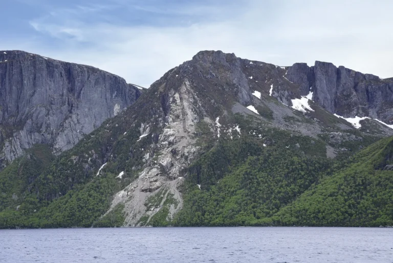
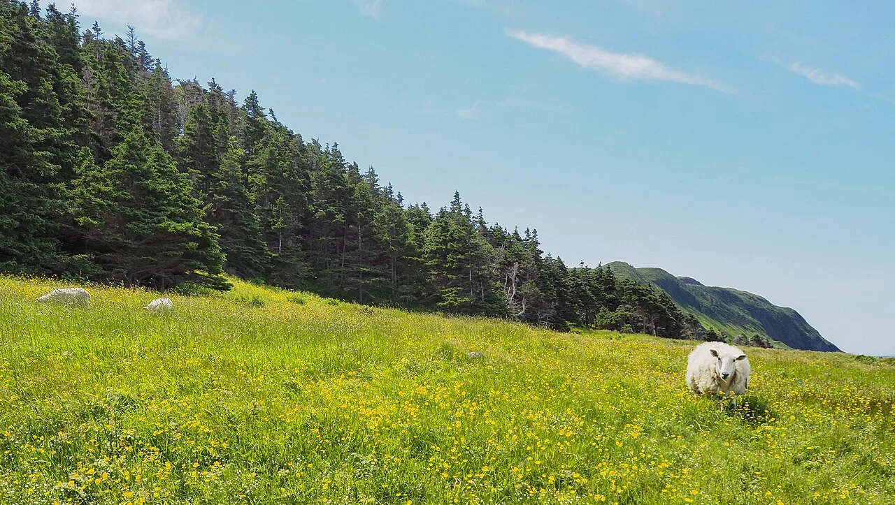
The Western Brook Pond trail is 6 km return (1–2 hours, 42 m of gain) across bogs and forested ridges to the shore of a land-locked fjord walled by cliffs that Parks Canada describes as 650 metres high. The trailhead is 27 km north of Rocky Harbour on Route 430. A 1.8 km side loop reaches the banks of Western Brook. As Parks Canada puts it, the view alone is worth the hike, even if you don’t take the boat.
Most people do. The Western Brook Pond boat tour is a 2-hour cruise with live interpretation, run by Bontours from mid-May to mid-October. Departures depend on wind and weather, pets aren’t allowed on board, and Parks Canada recommends reserving: call 1-888-458-2016 or visit the ticket office on Pond Road in Rocky Harbour. Allow about 45 minutes to walk to the dock. We don’t list ticket prices here; check them with Bontours directly.
Gros Morne Mountain (James Callahan Trail): what to expect
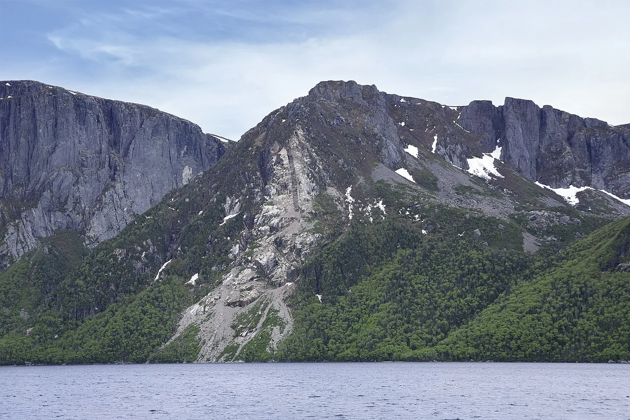
Gros Morne Mountain is the park’s highest point at 806 m, and the full hike is a 17 km return trip with about 1,000 m of elevation gain. Parks Canada rates it difficult and allows 6 to 8.5 hours. It comes in two parts:
- The approach (9 km return, 2.5–3.5 hours, moderate): through forest along Crow Gulch Brook to a viewing platform at the base of the mountain, with views of waterfalls and Crow Cliff. Turn around at the bridge if you want something shorter.
- The summit loop (8 km, about 3.5–5.5 hours, difficult): a steep climb up a rocky gully to the arctic-alpine plateau, then a rough, boulder-strewn descent through Ferry Gulch. The gully is the only part of the park’s developed trail network without built steps or boardwalk.
Seasonal closure: to protect wildlife during calving and nesting, Parks Canada closes the summit trail from May 1 until June 28. Parks Canada says it protects newborn caribou and ptarmigan.
Parks Canada’s preparation advice is specific. Don’t cross the summit when it’s in cloud, as visibility is poor. There’s no food, shelter or water on the mountain. Carry at least 3 litres of water per person (5 on hot days), a windbreaker, a sweater and long trousers for the top, lunch and snacks, a first-aid kit with blister treatment, and well broken-in boots. Dogs are strongly discouraged. There’s a primitive campsite at Ferry Gulch; a camping permit is required.
Multi-day and backcountry hikes
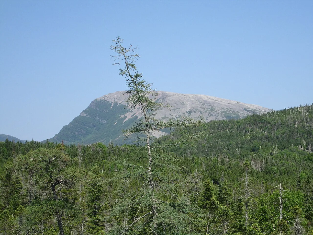
Above the fjords lies the Long Range plateau, where Parks Canada says there are no built trails at all. Its wilderness hiking page lists seven backcountry routes, all unmarked or partly unmarked, needing map, compass and GPS skills:
- Snug Harbour (day hike, 15 km, 6–8 hours) to a cove at the base of the Western Brook Pond cliffs.
- Snug Harbour to North Rim (2 days, 24 km) and Ferry Gulch to Bakeapple Pond (2 days, 20 km).
- Northern Traverse (3–4 days, 27 km) and Long Range Traverse (3–5 days, 35 km), or both combined (5–7 days, 60 km).
Overnight routes and through hikes need a reservation, online through the Parks Canada Reservation Service or by phone at 1-877-737-3783. Parks Canada says they are only for fit, experienced backcountry hikers who can navigate unmarked terrain; read its Hiker Preparation Guide to the Long Range Mountains first.
When to hike in Gros Morne
The main hiking season runs from late spring to early fall. Three official dates shape your plans:
- Mid-May to mid-October: the Western Brook Pond boat tour runs.
- May 1 to June 28: the Gros Morne Mountain summit trail is closed for wildlife.
- Early October: Parks Canada singles out fall colours on the Stuckless Pond Trail (although its bridge was out when we checked; see the bulletins).
Weather on the mountain is cooler and windier than at sea level, and forest trails such as Baker’s Brook Falls can be buggy, so pack layers and insect repellent. Check Parks Canada’s bulletins for closures before each hike. If you’re still deciding where to go in Atlantic Canada, our bucket-list trips from Canada guide puts Gros Morne alongside other big Canadian trips.
Getting to Gros Morne from Halifax
Fly Halifax to Deer Lake (YDF)
The fastest way from Halifax is a flight to Deer Lake Regional Airport. Parks Canada says YDF is 35 km from the park’s southern boundary, about 30 minutes away, with direct flights from Halifax, Toronto, St. John’s and (May to October) Montreal. On November 1, 2026, Deer Lake’s own arrivals board listed Halifax flights on both Porter and Air Canada, but schedules change, so search Halifax to Deer Lake flights for your dates. Our cheapest places to fly from Halifax guide has more routes from YHZ.
Rent a car at Deer Lake
Parks Canada notes that several major car rental agencies operate at Deer Lake airport, and that bus services run from the town of Deer Lake to the park. Trailheads are spread from Trout River to Shallow Bay, though, so a car is far more practical. Compare Deer Lake rental cars and book early for summer. No credit card? See renting a car without a credit card in Canada. Moose live throughout the park, so drive with care, especially in low light.
Drive and take the ferry
To bring your own car, drive to North Sydney, Nova Scotia, and take the Marine Atlantic ferry to Port aux Basques. Marine Atlantic runs this route year-round and daily, with a crossing of approximately 7 hours; reservations are strongly recommended. From Port aux Basques, Parks Canada puts the park’s southern boundary 300 km away, about a four-hour drive. If you’re renting at Halifax for the drive, see our Halifax airport car rental guide. For a full island route that includes Gros Morne, follow our 7-day Newfoundland road trip itinerary.
Park fees, passes and safety
You need a park pass to visit. Parks Canada’s fees page lists these daily admission fees (checked November 1, 2026). Youth 17 and under are free.
| Daily admission | Regular | Winter (Nov 1–May 15) |
|---|---|---|
| Adult (18–64) | $12.25 | $10.00 |
| Senior (65+) | $10.75 | $8.75 |
| Family/Group (up to 7 in one vehicle) | $24.50 | $19.50 |
If you’re visiting several national parks in a year, the Parks Canada Discovery Pass ($83.50 adult, $71.50 senior, $167.50 family/group) covers admission across the country. Backcountry fees are extra: $124.00 per person for the Long Range Traverse and $102.25 for the Northern Traverse.
For safety, Parks Canada asks hikers to choose trails that match their abilities and check current trail conditions. In an emergency, dial 911; the 24/7 Emergency Dispatch Centre is 1-877-852-3100. Cell coverage is limited in parts of the park, so tell someone your plans. See its safety page and wildlife page. For gear and phone data, browse our travel essentials guides.
FAQ
What is the best hike in Gros Morne?
For a big day, Gros Morne Mountain (17 km, 6 to 8.5 hours, difficult). For most visitors, the easy Tablelands and Western Brook Pond trails give the most scenery for the least effort.
How long is the Gros Morne Mountain hike?
Parks Canada lists it as 17 km return with about 1,000 m of elevation gain, taking 6 to 8.5 hours.
Is Gros Morne Mountain hard?
Yes. Parks Canada rates it difficult. The gully climb is steep, the summit is often in cloud, and there is no water or shelter, so carry at least 3 litres of water per person.
What's the easiest hike in Gros Morne?
The shortest rated trail is the Mattie Mitchell Trail, a 250 m loop of about 15 minutes. For scenery, the Tablelands, Western Brook Pond, Berry Head Pond and Southeast Brook Falls trails are all rated easy by Parks Canada.
Do you need a car in Gros Morne?
In practice, yes. Trailheads are spread along Routes 430 and 431. Buses run from the town of Deer Lake, but a car is far simpler.
What's the closest airport to Gros Morne?
Deer Lake Regional Airport (YDF). Parks Canada says it is 35 km from the park's southern boundary, about 30 minutes away, and that several major car rental agencies operate there.
When is the best time to hike in Gros Morne?
Summer and early fall. The Western Brook Pond boat tour runs from mid-May to mid-October, and the Gros Morne Mountain summit trail is closed from May 1 until June 28 to protect wildlife.
Do you need a reservation for the Western Brook Pond boat?
Parks Canada says reservations are recommended. Book with the operator, Bontours, at 1-888-458-2016 or at its ticket office on Pond Road in Rocky Harbour. Departures depend on wind and weather.
Gros Morne trip essentials
Tools we’d use ourselves. Always check current prices and terms before you book.
- Flights to Deer LakeSearch fares from Halifax (YHZ) to Deer Lake (YDF). Search flights →
- Rental carCompare cars at Deer Lake airport. Compare rental cars →
- Park passDaily or Discovery Pass from Parks Canada. Parks Canada fees →
Related guides
The Moonlight Letter
Get Halifax & Atlantic Canada travel deals
Cheap-flight finds from YHZ, road-trip ideas and new guides, straight to your inbox.
We'll only use your email to send Moonlight Travel deals and guides. Unsubscribe anytime. See our Privacy Policy.